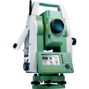
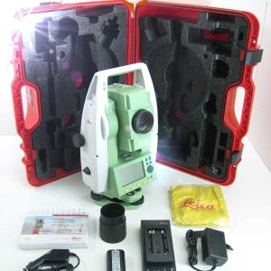
Leica FlexLine TS06 Plus R500 Reflectorless Total Station
Leica FlexLine TS06 Plus R500 Reflectorless Total Station
The Leica FlexLine TS06 Plus is designed to meet mid to high applications and comes standard with a full alphanumerical keyboard, host USB and built-in Bluetooth to make the TS06plus quicker and more convenient to use.

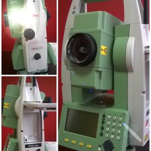
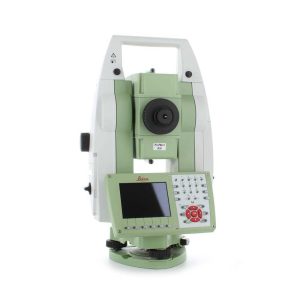
Leica FlexLine TS07 Manual Total Station
Leica FlexLine TS07 Manual Total Station
Leica FlexLine TS07 is a high-quality manual total station that is based on a proven product concept that has been revolutionizing the world of measurement and survey for nearly 200 years.
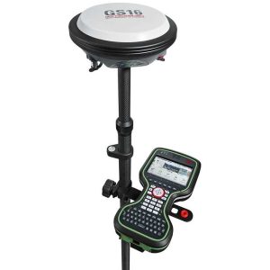
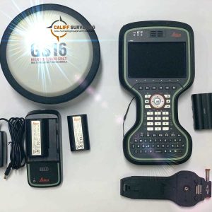
Leica Viva GS16 GNSS Smart Antenna
Leica Viva GS16 GNSS Smart Antenna
Leica Viva GS16 is the most compact and powerful, self-learning GNSS smart antenna. Working with the leading RTK technology, the Viva GS16 meets the highest standards in measurement excellence with RTKplus and SmartLink.

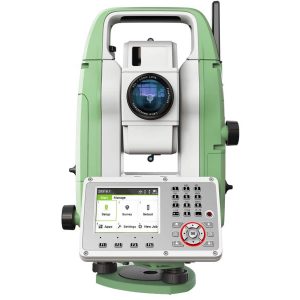
Leica Viva TS16 I 5″ R1000 Self Learning Total Stations
Leica Viva TS16 I 5″ R1000 Self Learning Total Stations
Meet the world’s first self-learning total station. Automatically adjusting to any environmental conditions, the Leica Viva TS16 locks onto your, and only your, target. Regardless of how challenging the task or the number of distractions in the field, this total station exceeds your expectations.
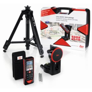
Leica DISTO S910 Laser Distance Meter
Leica DISTO S910 Laser Distance Meter
The Leica DISTO S910 is a handheld laser distance meter that accurately measures various applications’ distances, angles, areas, and volumes. With a range of up to 300 meters and an accuracy of ±1mm, the S910 is perfect for construction, architecture, and surveying professionals.


Leica RTC360 3D Laser Scanner
Leica RTC360 3D Laser Scanner
Leica RTC360 Laser Scanner is the new solution empowering users to document and capture their environments in 3D.

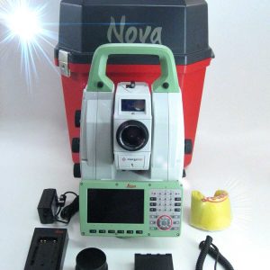
Leica Nova TS60 Robotic Total Station
Leica Nova TS60 Robotic Total Station
Leica Nova TS60 is the world’s most accurate total station, enabling you to work with the best angular (sub-second) and distance accuracy (sub-millimeter).
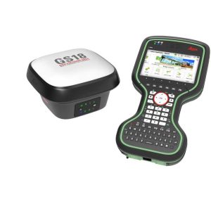

Leica GS18 T GNSS RTK Rover
Leica GS18 T GNSS RTK Rover
Leica GS18 T antenna offers a world of possibilities like never before in the area of complex measurements and setups in difficult environments. It combines all the advantages of the Leica Viva GS16 antenna (including the first RTK+ smart managing technology) with the inertial measurement unit to be the first true tilt compensation solution immune to magnetic disturbances and it is calibration-free.

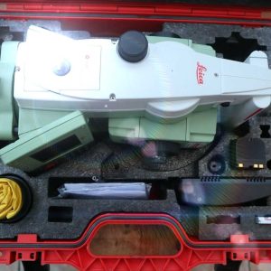
Leica FlexLine TS02 Total Station
Leica FlexLine TS02 Total Station
Leica Flexline TS02 is the perfect Total Station for standard measuring. Using standard application software it is designed for moderate accuracy applications and below.
Leica Viva TS15 R30 1″ Robotic Total Station
Leica Viva TS15 R30 1″ Robotic Total Station
Leica Viva TS15 adds an advanced image sensor to the already proven total station sensors. With unique capture-sketch-link functionality, total station images can be captured, enhanced with sketching, and linked to any point of interest.


Leica BLK360 G2 Imaging Laser Scanner
Leica BLK360 G2 Imaging Laser Scanner
Leica BLK360 Imaging Laser Scanner is designed to help new-to-LiDAR users capture point clouds and unlock the potential of using them in many different applications.

Leica Nova MS60 First Self-Learning MultiStation
Leica Nova MS60 First Self-Learning MultiStation
Leica Nova MS60 MultiStation combines upgraded, faster 3D laser-scanning capabilities, GNSS connectivity, and digital imaging with a high-end total station.
