
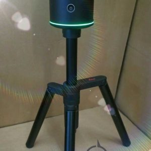
Leica BLK360 G2 Imaging Laser Scanner
Leica BLK360 G2 Imaging Laser Scanner
Leica BLK360 Imaging Laser Scanner is designed to help new-to-LiDAR users capture point clouds and unlock the potential of using them in many different applications.
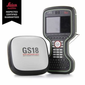
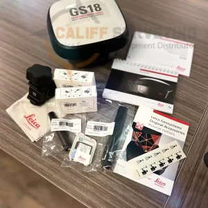
Leica GS18 I GNSS RTK Rover with Visual Positioning
Leica GS18 I GNSS RTK Rover with Visual Positioning
Califf Surveying proudly presents the Leica GS18 I GNSS RTK Rover. This is the first smart GNSS rover that allows you to measure points from images.
Leica iCON iCS50 Robotic Construction Tool
Leica iCON iCS50 Robotic Construction Tool
If your layout is costing you time, the Leica iCON iCS50 Robotic Construction Tool is the upgrade your crew needs. Built for speed on active sites, it helps you set out points fast, check installs, and capture as-builts with confidence—without dragging the schedule. The iCS50 is made for construction teams who want dependable accuracy, smoother workflows, and fewer call-backs from layout errors. Get it from CALIFF SURVEYING with the right configuration, accessories, and shipping—message us now for current price and stock.

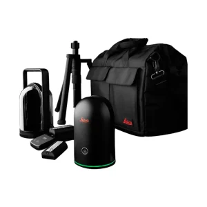
Leica BLK2GO Handheld Imaging 3D Laser Scanner
Leica BLK2GO Handheld Imaging 3D Laser Scanner
The designers created the Leica BLK2GO Handheld Imaging 3D Laser Scanner for surveyors, engineers, and construction workers. It offers fast, accurate, and mobile reality capture.
The BLK2GO is designed to map complex areas in real-time. It uses advanced SLAM technology and a dual-axis LiDAR sensor. This helps create detailed 3D models as you walk.
Leica iCG70 iCON GPS 70 RTK GNSS Rover
Leica iCG70 iCON GPS 70 RTK GNSS Rover
The combination of the latest GNSS technology and inertial measurement unit (IMU) equips the iCON GPS 70 T with permanent tilt compensation and makes it resistant to any magnetic interference.
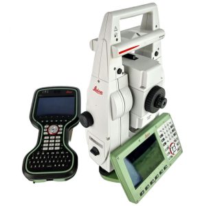
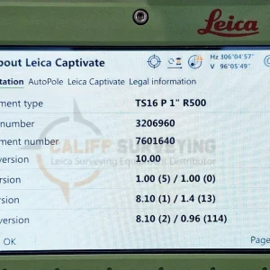
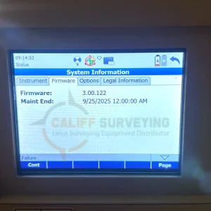
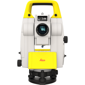
Leica TS16 P 1″ R500 Robotic Total Station CS20
Leica TS16 P 1″ R500 Robotic Total Station CS20
Meet the world’s first self-learning total station. Automatically adjusting to any environmental conditions, the Leica Viva TS16 locks onto your, and only your, target.
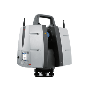
Leica ScanStation P30 3D Laser Scanner
Leica ScanStation P30 3D Laser Scanner
The Leica ScanStation P30 3D Laser Scanner is a terrestrial laser scanning (TLS) solution built for professionals who need reliable accuracy and consistent point cloud quality on real projects. It’s commonly used for as-built documentation, construction verification, topographic mapping, and industrial facility scanning, helping teams capture detailed site conditions for modeling, clash detection, and measurement deliverables.
Leica BLK360 G1 3D Laser Scanner
Leica BLK360 G1 3D Laser Scanner
The Leica BLK360 G1 is a compact imaging laser scanner designed for fast, practical reality capture in buildings and jobsite environments. It’s a popular choice for scan-to-BIM, as-built documentation, renovation planning, and facility mapping, helping teams capture point clouds and visual context without hauling large scanning rigs.
Leica iCON iCB70 5″ R500 Manual Total Station Kit
Leica iCON iCB70 5″ R500 Manual Total Station Kit
The Leica iCON iCB70 manual construction total station makes you layout more points per day on your construction project with either prism or reflectorless measurements.
Leica iCON iCT30 – Layout Tool for Construction
Leica iCON iCT30 – Layout Tool for Construction
The iCT30, in combination with Leica iCON Build field software, is an easy-to-use solution that facilitates the move from traditional analog layout methods to modern digital techniques.
Leica iCON iCR80 Robotic Construction Total Station
Leica iCON iCR80 Robotic Construction Total Station
Stop losing time on layout mistakes. The Leica iCON iCR80 Robotic Construction Total Station is built for high-speed, high-accuracy construction work—so you can stake points faster, verify installs, and deliver as-builts without slowing the crew down. Designed for efficient one-person operation on demanding sites, the iCR80 helps cut rework, reduce labor, and keep schedules tight on concrete, steel, and MEP layout.
Leica iCON iCS20 Motorised Construction Tool
Leica iCON iCS20 Motorised Construction Tool
Speed up layout and stop wasting hours on rework. The Leica iCON iCS20 Motorised Construction Tool is built for construction teams that need fast stakeout, quick verification, and clean as-built capture on busy jobsites. With motorised performance and jobsite-ready accuracy, iCS20 helps you lay out points efficiently, confirm installs sooner, and keep crews moving—especially for concrete, MEP, and general layout tasks.
