Leica iCON: The Complete Guide for Modern Construction Layout
- March 15, 2026
- 2 Comment(s)
Construction layout has changed more in the last decade than in the previous fifty years. Tape measures, plumb bobs, and string lines aren’t gone, but they’re no longer enough to keep pace with tighter tolerances, compressed schedules, and the rapid shift toward Building Information Modeling (BIM).
Leica Geosystems’ iCON product line is built for the way modern construction teams actually work in the field. These robotic total stations and construction sensors are designed for one-person operation, run construction-specific software, and integrate directly with BIM models and CAD files. Whether you’re laying out anchor bolts on a concrete deck or verifying as-built conditions against a 3D model, the iCON platform is built to make that process faster and more accurate.
What is the Leica iCON Robotic Construction Total Station?
A robotic total station is a motorized electronic surveying instrument that measures angles and distances with high precision. What makes it “robotic” is the ability to automatically track a target (typically a prism on a pole) and be controlled remotely by a single operator. That’s a significant upgrade over traditional total stations, which require one person behind the instrument and another to hold the prism.
The Leica iCON line takes that concept and tailors it specifically for the construction industry. Surveying-grade total stations are designed for a broad range of geospatial applications, but iCON instruments are optimized for the tasks construction crews perform every day. Layout, as-built verification, and quality checks are the core workflows, and the hardware and software are built around making those tasks as simple and productive as possible.
![]()
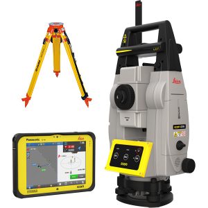
A complete iCON solution has three main components:
- The Instrument: The iCON hardware lineup includes robotic total stations (iCR70 and iCR80), construction sensors (iCS20 and iCS50), and the iCT30 construction layout tool. Each instrument is motorized and capable of one-person operation, but they vary in range, accuracy, and the types of projects they’re best suited for. The robotic total stations offer the longest range and most advanced target tracking, while the construction sensors are more compact and designed for interior finishing and trade-specific work.
- The Software: Leica iCON build is the field software that ties the hardware together. It runs on a tablet or field controller, allowing crews to work directly with design data on site, import 2D CAD drawings or fully rendered 3D BIM models, and use them to drive layout and verification workflows. The software handles all the calculations in the background, so operators don’t need to be trained surveyors to get accurate results. It also supports IFC file formats, giving teams a direct connection to BIM workflows without needing to convert or simplify their models first.
- Support and Services: Hardware and software only deliver full value when backed by proper training and ongoing support. Leica Geosystems offers training programs and workflow consulting, and its ConX cloud platform enables field crews to work with up-to-date design data while sending reports back to the office in real time.
![]()
Benefits of Using Leica Robotic Total Stations
The shift from manual layout methods to robotic total stations changes how construction teams work in ways that go well beyond measuring faster.
One-Person Operation
This is the most immediate practical advantage. Traditional layout requires two people, one operating the instrument and one holding the rod or marking points. A robotic total station automatically tracks the prism, so the same operator can set up the instrument, walk to the target location, and independently lay out points. On a busy site where labor is already stretched thin, freeing up even one crew member per layout task adds up fast over the course of a project.
Faster Layout With Fewer Errors
Manual layout using tape measures, plumb bobs, and string lines is inherently limited by the skill of the person doing the measuring and the number of physical steps involved. Every measurement is a chance for human error. Robotic total stations automate the angle and distance calculations, and the software also flags discrepancies on the spot. The result is faster point-to-point layout and significantly fewer expensive mistakes that would otherwise show up later as rework.
BIM Integration
As more projects adopt BIM, the ability to work with 3D model data in the field is becoming even more essential. The iCON build software supports fully rendered IFC models, allowing field crews to select objects like columns, pipes, or wall penetrations directly from the 3D model and lay them out on site. That’s a significant step beyond working from 2D plan sheets, because it preserves the full design intent and eliminates the errors that happen when complex geometries get reduced to lines and rectangles on paper.
Lower Total Cost of Ownership
Leica Geosystems total stations are built for durability and supported by an extensive service network, helping preserve the investment’s residual value. When you factor in the labor savings from a one-person operation and the rework you avoid through better accuracy, the return on investment builds quickly.
Better Documentation and Accountability
Every measurement taken with a robotic total station is logged digitally and becomes part of the project record. That documentation matters when you need to prove compliance, resolve disputes, or hand over accurate as-built information at the end of the project.
How Does a Leica Robotic Total Station Work?
A robotic total station combines three core technologies. The motorized theodolite measures horizontal and vertical angles, a laser distance meter measures distance to a target, and a communication system connects the instrument to a handheld controller or tablet at the prism pole.
The key technology that enables one-person operation is Automated Target Recognition (ATR), which uses the instrument’s laser beam to locate and lock onto a prism. Once locked, the instrument’s motors automatically follow the prism as the operator moves across the site, continuously updating angle and distance measurements. The iCR80 takes this further with ATR+ technology, which filters out the distractions common on congested construction sites, including reflective surfaces, machinery, safety vests, and nearby prisms. It also has the fastest re-lock capability on the market, so when the line of sight is temporarily blocked by a passing forklift or a worker walking through the beam, the instrument quickly reacquires the target.
When the instrument loses its target entirely, the iCR70 uses SpeedSearch to rapidly scan and relocate the prism. The iCR80 adds PowerSearch, a patented technology that uses a rotating laser to find the prism faster across a wider search area. Both features minimize downtime and keep the layout process moving.
The iCON build software manages the entire workflow from setup to task completion, and the Setup Pilot app automates instrument orientation with minimal manual input. Layout routines let the operator select points, lines, or objects from the design file and navigate to each position using on-screen guidance. Verification tools let crews measure existing conditions against the design and flag deviations in real time. All calculations are performed in the background, so the operator doesn’t need to understand coordinate transformations or atmospheric corrections. They select a point, walk to it, and mark it, while the software handles everything else.

Where and When to Use Robotic Total Stations
Leica iCON robotic total stations show up across a wide range of construction applications. The common thread is any task that requires the precise positioning of design elements in the physical world.
Building Construction Layout
As the primary use case, foundation layout, structural steel positioning, anchor bolt placement, elevator shaft alignment, curtain wall installation, and floor-by-floor layout of walls, doors, and columns all fall within the scope of a robotic total station’s daily work on commercial building projects.
MEP and HVAC Installation
Mechanical, electrical, and plumbing work involves some of the most detail-intensive layouts on any building project. Hanger locations, wall penetrations, sheet-metal inserts, and conduit routing all need to be placed precisely to avoid conflicts with other trades and to match the coordinated model. The Layout Objects app lets crews tap directly on a pipe, duct, or fitting in the 3D model and lay it out in the field.
Infrastructure and Civil Works
While the iCON line is optimized for building construction, the iCR80 can also control construction machines, including curb-and-gutter machines, pavers, graders, and dozers. That makes it a versatile choice for contractors working on both building and civil projects.
Interior Finishing
The iCS20 and iCS50 construction sensors are well-suited for fitting out interiors, using laser projection and visual measurement technology to speed up drywall layout, ceiling grid installation, flooring, and millwork. Trades contractors who previously relied on manual methods often see the biggest time savings during this phase, especially in buildings with complex geometries where manual measurements drift over long distances.
As-Built and Quality Verification
Beyond initial layout, robotic total stations are also increasingly being used to verify that completed work matches the design. Checking slab flatness, confirming column positions, and documenting MEP installation accuracy can all be completed on site with immediate results, and the data feeds directly back into the project model.

How to Use a Leica Robotic Total Station
The learning curve for iCON instruments is deliberately shorter than many people expect. Leica designed the system so that field crews with no prior surveying experience can be productive quickly.
Step 1: Prepare Your Design Data
Export the relevant layout data from your BIM authoring tool (Revit, Tekla, ArchiCAD, or similar) and load it onto the field controller. The iCON build software accepts 2D CAD files and 3D models in IFC format. Organize your layout points into logical work packages to keep your field workflow efficient.
Step 2: Set Up the Instrument
Place the total station on its tripod with a clear line of sight to your work area. The Setup Pilot app automates the orientation process, walking you through station positioning step by step. Crews familiar with the workflow can be set up and ready to lay out in a few minutes.
Step 3: Run Layout
Walk to each layout point with the prism pole. The tablet screen shows your position relative to the design point and guides you to the exact location. Once you’re within tolerance, confirm the point, mark it, and move to the next one. The total station automatically follows your prism.
Step 4: Perform Verification
Use the iCON field verification app to check installed work against the design. The software shows pass/fail results for each point and generates reports that can be shared with the project team immediately.
Tips for Getting the Best Results
- Protect your control network: Survey control points are the foundation of every setup, so make sure they’re well-placed, clearly marked, and protected from disturbance.
- Check your setup frequently: On long layout sessions or when environmental conditions change (like temperature swings), re-check against a known point to confirm your setup is still accurate.
- Keep the prism clean: Dust, mud, or damage to the prism degrades tracking performance and measurement accuracy.
- Plan your instrument position: Place the total station with the best line of sight to the most points in your current work area to reduce setups and the time spent re-establishing position.
Top 5 Leica iCON Robotic Construction Total Stations
Leica Geosystems offers a powerful lineup of construction tools designed specifically for construction workflows. Below are five of the most advanced iCON solutions available today.
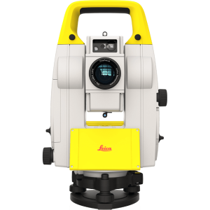
1. Leica iCON iCR70 Robotic Total Station ($9,999.00)
The iCR70 is Leica’s mid-range robotic total station for construction, and it’s the model most teams will start with when moving from manual methods to digital layout. It supports one-person operation with ATR and SpeedSearch technology, and it works with both 2D CAD and 3D BIM models through the iCON build software.
The Layout Objects app lets crews tap directly on model objects to lay them out on site. Leica positions the iCR70 as delivering approximately an 80% increase in productivity compared to conventional layout practices, and crews with no surveying background can learn it quickly with minimal training.
2. Leica iCON iCS20 Construction Sensor ($10,999.00)
The iCS20 is a compact, motorized 3D measurement and layout sensor built for interior finishing, MEP trade work, and as-built documentation. It uses a high-resolution camera that streams a live view to the operator’s tablet, allowing them to see exactly what the instrument sees and select measurement points visually.
![]()
Its automated workflows, auto-setup process, and continuous position monitoring make it practical for trades contractors who need a smaller, more portable package.
3. Leica iCON iCS50 Construction Layout Tool ($16,999.00)
The iCS50 builds on the iCS20’s foundation, adding robotic functionality via Leica’s vPole and vPen accessories. The vPole uses visual-based target tracking with automatic tilt compensation and height detection, so the operator can lay out more points faster, including hidden points that would be difficult to reach with a laser-only approach. The vPen is a wireless measuring pen for high-precision, short-range work, such as creating digital templates for countertops, splashbacks, and other custom fabrication pieces.
![]()
The ability to switch among laser, vPole, and vPen methods within the same workflow gives the iCS50 exceptional flexibility. It runs on the Leica iCON trades software, which supports direct export of CNC-ready DXF files, so measurements taken in the field go straight to the shop floor.
4. Leica iCON iCR80 Robotic Total Station ($9,999.00)
The iCR80 is the flagship of the iCON lineup, built for the most demanding sites and the widest range of applications. ATRplus technology keeps it locked on the operator’s target while filtering out reflections, moving equipment, and other prisms on congested sites. The “tune out targets” feature and Dynamic Lock capability make it especially effective on large, busy projects.
![]()
The iCR80 also supports machine control applications for graders, dozers, pavers, and milling machines, making it a strong choice for contractors working on both building and civil projects. Long-range Bluetooth connectivity (up to 400 meters) maintains stable communication with the controller, and the instrument handles layout, verification, and machine control across multiple project types.
5. Leica iCON iCT30 Construction Theodolite ($8,480.00)
The iCT30 is the most accessible instrument in the lineup, designed as an affordable entry point for contractors and trades who want to move from analog methods to digital layout.
It’s a motorized layout tool with a measurement range of up to 80 meters and angular accuracy of 9 arc-seconds, which covers the majority of standard building layout applications. It runs the same iCON build field software as the rest of the lineup, including full support for IFC models and the Layout Objects app. For contractors still working with tape measures and string lines, the iCT30 is a practical first step toward digital layout at a much lower price point than a full robotic total station.
Why Choose Califf Surveying for Leica Total Stations
At Califf Surveying, we provide construction professionals with access to Leica Geosystems’ most advanced measurement technology. As a trusted supplier of Leica surveying equipment, we help contractors and engineers find the right instrument for their workflow, whether it’s a full robotic total station package for a large commercial project or an entry-level layout tool for a crew transitioning to digital methods.
Beyond equipment, Califf Surveying supports the full lifecycle of your investment. That includes helping you understand which models and configurations fit your applications, getting your teams up and running with the iCON build software, and providing ongoing support as your needs evolve.
Explore our Leica products to see what’s available, or learn more about Califf Surveying and how we support construction professionals across the industry.
Conclusion
Construction layout is moving from analog to digital, and the pace is accelerating as projects grow more complex and BIM becomes the expectation rather than the exception. Leica iCON robotic total stations are purpose-built for this transition, giving construction professionals the accuracy, speed, and workflow integration they need to keep up.
Whether you’re a trades contractor looking at the iCS20 for interior measurement, a layout crew evaluating the iCR70 for building construction, or a large contractor who needs the iCR80’s machine control capability, the iCON lineup covers the full range of construction applications. The shared iCON build software platform means your investment in training carries across every instrument in the range.
For professionals seeking reliable Leica surveying equipment and expert guidance, Califf Surveying is a trusted partner for construction measurement solutions. Browse our Leica products to find the right solution for your next project, or contact us for a personalized equipment recommendation.
2 comments on “Leica iCON: The Complete Guide for Modern Construction Layout”
Comments are closed.