

Leica BLK2FLY Autonomous Flying Laser Scanner
Leica BLK2FLY Autonomous Flying Laser Scanner
The Leica BLK2FLY Autonomous Flying Laser Scanner gives engineers a smarter way to capture exterior environments. Its drone platform can scan walls, roofs, and tall structures accurately. This makes it great for construction, infrastructure, and inspection tasks.


Leica BLK2GO Handheld Imaging 3D Laser Scanner
Leica BLK2GO Handheld Imaging 3D Laser Scanner
The designers created the Leica BLK2GO Handheld Imaging 3D Laser Scanner for surveyors, engineers, and construction workers. It offers fast, accurate, and mobile reality capture.
The BLK2GO is designed to map complex areas in real-time. It uses advanced SLAM technology and a dual-axis LiDAR sensor. This helps create detailed 3D models as you walk.
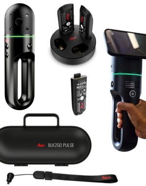
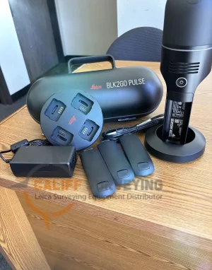
Leica BLK2GO Pulse Handheld Imaging Laser Scanner Wireless
Leica BLK2GO Pulse Handheld Imaging Laser Scanner Wireless
The designers created the Leica BLK2GO Pulse Handheld Imaging Laser Scanner for surveyors and reality-capture experts. It provides fast, accurate 3D data on the go.
Leica BLK360 G2 Imaging Laser Scanner
Leica BLK360 G2 Imaging Laser Scanner
Leica BLK360 Imaging Laser Scanner is designed to help new-to-LiDAR users capture point clouds and unlock the potential of using them in many different applications.
Leica RTC360 3D Laser Scanner
Leica RTC360 3D Laser Scanner
Leica RTC360 Laser Scanner is the new solution empowering users to document and capture their environments in 3D.
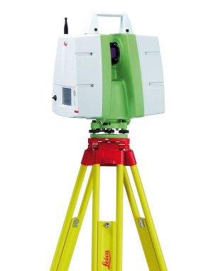
Leica ScanStation C10
Leica ScanStation C10
Leica ScanStation C10 platform represents the most capabilities and best value packed into a single laser scanner instrument. Users can take advantage of surveyor-friendly, onboard total station-like control or use an external laptop for even more powerful, onsite viewing and data processing.
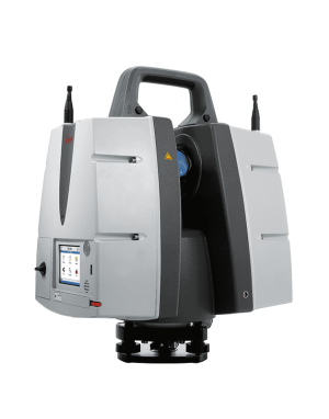
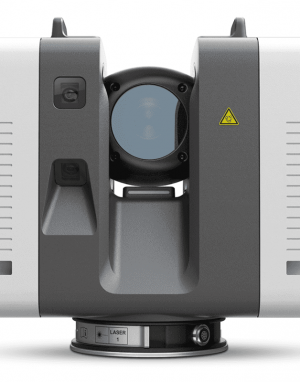
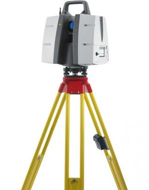
Leica ScanStation P30 3D Laser Scanner
Leica ScanStation P30 3D Laser Scanner
The Leica ScanStation P30 3D Laser Scanner is a terrestrial laser scanning (TLS) solution built for professionals who need reliable accuracy and consistent point cloud quality on real projects. It’s commonly used for as-built documentation, construction verification, topographic mapping, and industrial facility scanning, helping teams capture detailed site conditions for modeling, clash detection, and measurement deliverables.
Leica ScanStation P40 3D Laser Scanner
Leica ScanStation P40 3D Laser Scanner
The Leica ScanStation P40 is a long-range terrestrial laser scanner built for demanding reality capture projects where accuracy and reliability matter. It’s widely used for topographic surveys, as-built documentation, industrial plant scanning, and forensics, helping teams capture dense, high-quality point clouds for modeling, clash detection, and verification.
Leica ScanStation P50 3D Terrestrial Laser Scanner
Leica ScanStation P50 3D Terrestrial Laser Scanner
Leica ScanStation P50 3D Terrestrial Laser Scanner combines all the well-known features of the P40 plus a longer-range scanning capability of more than 1 kilometer. Adding this feature enables professionals to capture 3D scans at great distances with angular accuracy paired with low range noise and survey-grade dual-axis compensation.
